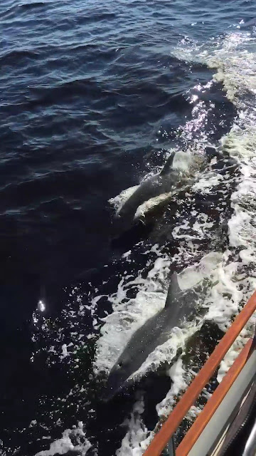
We passed the canal that takes you to Port St. Joe, another good place to stay in the area. At 40 miles into our journey we sailed into East Bay and stretched our eyeballs as the banks opened into bigger water. Dolphins came alongside us and escorted us as we looked for the red nun buoys that marked the channel.
The GICW made some lazy turns as we passed under the Hwy 98 Bridge next to the Raptor Ranch at Tyndall AFB. Heading north and between Ferry Pt. and Parker Pt. we turned due west for a few miles then headed NW to Bunkers Pt. From there we could see Panama City Marina to the north. We called on channel 16 and the dock master switched us to channel 12 and gave us instructions on how to enter and where to turn to get to the fuel doc. After some maneuvering in the busy harbor, we got tied up to the fuel dock and topped off the tanks. The dock master had us move alongside the transient dock for our stay, so we plugged into the 50-amp pedestal, turned on the A/C and relaxed with a cool drink and a map of the area so we could plan our exploration of Panama City.
That's the news and here's the views:
We are here
The 62 mile route from Apalachicola to Panama City, FL along the GICW
Early morning departure from the Water Street Marina and Hotel in Apalachicola, FL
Looking back at where we stayed as we rounded the green and red divider buoy taking us into the GICW
The old rusty railroad swingbridge just up the GICW from Apalachicola
Entering into Lake Wimico
A floating fish camp in the middle of nowhere
Churning along in "The Ditch"
These guys were around every day
The view from the transient dock in Panama City Marina
Lots of good the fake owl does
Show me the FOOD!


The odyssey begins; great writeup.
ReplyDeleteLoving the posts, George!
ReplyDelete