Tuesday, September 20, 2016

Bobby's Fish Camp to Demopolis AL

On 20 September we prepared for departure from Bobby's Fish Camp.  Viridian's engine was running before first light and all the navigation lights were burning.  This was going to be a 97-mile run all the way to Demopolis, AL.  The weather forecast was for clear skies all day, so all we had to do was slip away as soon as we could see enough to detect logs in the water and other vessels in our path.  I love early mornings on the water!

We had not encountered any tugs since Mobile so we were bound to see one soon.  There was one lock we needed to transit and it was located within sight of Demopolis Yacht Basin.  Alternate stopovers were planned in the event we could not make Demopolis by dark, but all looked favorable for an all-day run to the start of the Tenn-Tom Waterway.

The last line was untied, the crew was all aboard and Viridian bumped forward as the prop stirred the calm waters of the Tombigbee.  The firstmate had a waterway guide for the trip up the Tombigbee River and would read about the history of the area we were passing through along the way.  This was a nice way to enjoy the voyage and learn something about the area too.  Bald Eagles were starting to make themselves visible, and we began to learn how to spot one just by the way it flaps its wings in flight.  We saw, for the first time, homes built along the river.  Each one was on stilts or lifted above the flood plane and had grass growing down to the water.  It looked like we were back in civilization.

We steamed under the Nantahala Bridge at MM-164 and made our way to the Meridian & Bigbee Railroad Lift Bridge at MM-173.   The hours were short and rolled beneath the deep blue sky.  Lunch was taken underway and we took turns at the wheel.  Walks round the deck allowed us to use our legs, and bathroom breaks were taken in proportion to the amount of water consumed.  The river straightened out for us somewhat, and our progress North was more efficient.  The sun was getting low in the west when we got within haling distance from the Demopolis Lock & Dam at MM-213.  The Lockmaster there was a salty ole codger.  He had a tug in the lock heading downriver and told us to pull up on the right bank and STAY THERE AND DON'T MOVE TILL I TELL YOU!  So we did exactly what he told us to do and all was fine.  He walked out to the lock and was standing behind the railing as we slowly rose to the top.  His demeanor mellowed somewhat and he managed to allow a smile as he took stock of Viridian once she came up level.  The heavy lock doors opened and we could see our destination up ahead and we were another 59 feet higher.

We pulled up alongside the fuel dock and topped off the tanks with diesel, paid slip fees for two nights and fixed a small leak in the sight glass tube by tightening the hose clamp on the port tank.  We fired back up and idled out and around to the covered slips, where we barely made it under the 24 ft. high structure.  A nice lady helped tie us up and taught Meg a new knot for tying the vertical fenders to the side rail.  Time to unwind.

We are here

That's the news and here's the views:


 The route from Bobby's Fish Camp to Demopolis AL


Progress North: We are at the Yellow Dot

Demopolis Lock and Dam on the Tombigbee River near Demopolis, Alabama, USA. The lock is located about 4 miles (6.4 km) below the confluence of the Tombigbee and the Black Warrior Rivers. The lock and dam are one of a series of locks and dams that provide a 9-foot navigation channel on the Tombigbee River.

Kingfisher Bay Marina in Demopolis AL

Viridian is in Good Hands!

First Tug since Mobile

Safe and sound at Kingfisher Bay Marina in Demopolis AL

Monday, September 19, 2016

Three Rivers Lake to Bobby's Fish Camp

19 September 2016

After checking below deck and plotting our course for the day, we ate breakfast and used a lantern to see as we started bringing in the anchor so we could leave at first light.  As the chain started coming through the fairlead, we could see it was covered in a thick grease-like mud.  This had to be cleaned before stowing it back in the chain locker, so we hooked up the handy seawater wash hose under the bow pulpit and started washing the chain.... till the breaker tripped and the pump motor shut down. 

No problem, we will just do this the old fashioned way: tie a bucket to a rope and haul up 5 gallons of water at a time and wash off the chain, all 100 feet of it.  This activity lasted until I let go of the rope on one of my throws and the bucket drifted just out of reach of the hook stick.

No problem, Meg had a mop bucket, so she tied a rope to it and continued the washing of the chain till the knot she tied came untied and the bucket sank into the dark water, lost forever.  Well, we will just have to haul the rest of the chain in with mud on it and deal with it later.  Viridian's engine has been running since we started hauling up the anchor exercise, and as I walked aft to climb the steps to the fly bridge, there was my bucket, floating next to the swim platform.  I reached out to get it and we finished washing the chain and left the anchor, filled with mud, hanging just under the water as we started to exit our anchorage.  The sun was not up yet, but first light conditions gave us enough to see without the lantern.  Viridian's navigation lights were turned on, the anchor light was turned off and we followed our cookie crumb GPS track back out the way we came in to avoid running aground again.  Well, we were still under tidal influence and had 6 inches less water that when we came in.  The original route in got us stuck again so the captain had to guess where deeper water might be.  After a few failed attempts to clear the bar we finally managed to slip over, as the tide was rising and so was our anxiety.  When the depth sounder showed 8 feet of water under the keel we felt like cheering and hi-5’ing but we were two far apart so we just pumped our fists in the air.

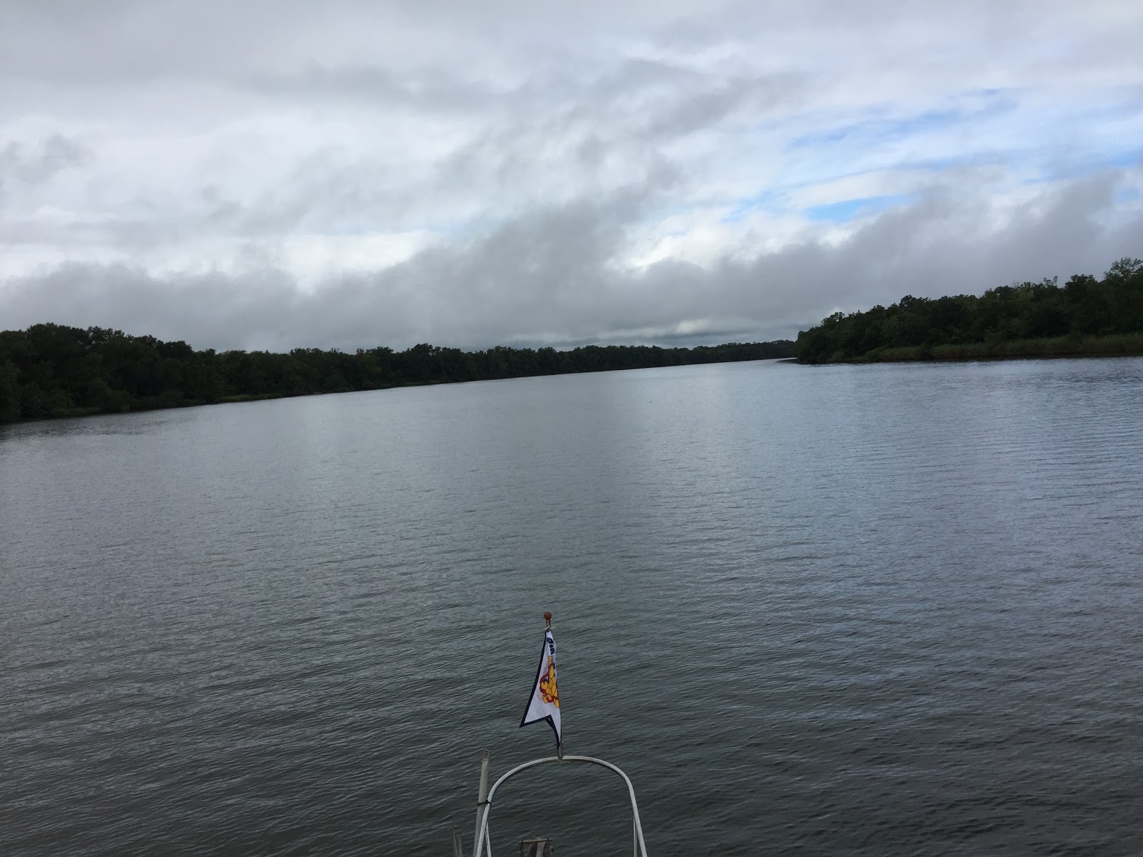
The morning air was cool and wispy fingers of thin fog pointed skyward from the Tombigbee River when we cleared the bar back into the main channel.  The sunbeams were leaking through the thick trees along the bank and reflecting off the water and thin fog as Viridian sliced her way northward toward our next destination, Bobby's Fish Camp just above Coffee Lock & Dam.  This was the last rain we would see for a very long time.  A record drought gripped the South this fall and didn't let go till months later.

The Tombigbee winds a torturous path north, making several 90-degree turns along the way.  Early in the morning, when the sun is still low in the eastern sky, the glare off the water makes it almost impossible to distinguish color when searching for the red and green channel marker buoys.  Even with expensive polarized sunglasses, everything appears in shades of black and grey.  Even while using binoculars to locate the channel markers, color did not show.  It finally dawned on us that this might be one reason for the red nun buoys being shaped like a triangle and the green can-buoys being shaped like a cylinder.

We squinted our way along the water route looking for the red-right-return markers and the occasional deadhead log floating butt-first pointed downriver.   At MM 88 we passed the PowerSouth Energy Co-Op and approached the Norfolk Southern Railroad Lift Bridge in Jackson.  The bridge operator raised the section and we passed under and Jackson, AL slowly shrank away as we droned on northward towards our destination 57 miles from Three Rivers Lake.  The Jefferson Davis Highway was next at MM 91 and the Tombigbee straightened out for us somewhat all the way to MM-114 just below the Coffee Lock & Dam.  Just before we reached the Jeff Davis Bridge, the captain radioed the Coffee Lockmaster and notified him of our location and ETA and asked if he could get us through.  The admiral slipped into her life jacket and went on deck to tie the large round fenders for a starboard tie to the lock bollard.  We were a little anxious since this was our first experience in this type of boat locking through.  We were not sure how our untested bollard loop would work or whether or not it would be difficult to loop on and off the bollard.  The Lockmaster was not busy at the time and he had the lock doors open for us to slide right in.   The captain was instructed to tie up at either the first bollard coming in or the last bollard next to the upstream doors. He said there would be less turbulence at these locations and our boat would not be pushed around as much.  All went well, everything worked smoothly and Viridian and crew rose 342 feet to the deep backwaters behind the dam.  Bobby's Fish Camp could be seen 2 miles upriver as we completed a sharp starboard turn once leaving the lock.  A headwind was blowing steady over 10 mph that made stopping alongside the small, single dock a breeze.  An elderly couple on a smaller boat was tied up and watching Viridian approach.  Meg tossed the man the bowline and he cleated it off as Viridian gently lay alongside the dock.  Once our boat was secure, the Captain shut down the engine and made sure all was secure.  It was good to have power and turn the a/c on to settle in for the evening.

We walked up to the marina store/restaurant and introduced ourselves to owner Lora Jane McIlwain, Bobby’s daughter.  She runs the place since Bobby passed away a few years ago.  We had a long conversation and heard some great stories about all the characters that stop by over time.  A hike around the grounds allowed us to stretch our legs and explore the area in this remote location on the Tombigbee River.

That's the news and here's the views:

We are here

Route from Three Rivers Lake to Bobby's Fish Camp


Bobby's Fish Camp is Located at the Yellow Dot


Departing Three Rivers Lake by way of narrow Channel (time-lapse)

A View Forward as we Departed Three Rivers Lake Anchorage

Good Example of the Tombigbee Route

PowerSouth Energy Co-Op - In 1941, PowerSouth was formed by 11 cooperatives to generate and sell electricity. First known as Alabama Electric Cooperative, the name was changed to PowerSouth Energy Cooperative in 2008 to better reflect the cooperative's geographical service territory and to position the company for future growth opportunities. Today, as one of 62 G&T cooperatives in the United States, PowerSouth is a trusted energy provider for the distribution members, who serve end-users in 39 Alabama and 10 Florida counties. (ref: PS web sight)

Norfolk Southern Railroad Lift Bridge in Jackson, AL

Looking aft at Jackson, AL

The multi-tasking First Mate

Coffeeville Lock and Dam are located on the Tombigbee River in Choctaw County, Alabama near the town of Coffeeville operated by the US Army Corps of Engineers.  Construction on the lock began in 1956 and while the lock was operational in 1960, all works were not completed until 1965. They were originally known as Jackson Lock and Dam.  As of December 2013, efforts are underway to install a 10 MW hydroelectric power plant on the dam. (Ref:wickipedia)

VIRIDIAN made fast to the Bollard inside the Coffee Lock


Bobby Dahlberg’s Fish Camp has been in this spot for almost 60 years. It is so tucked away that folks just a county or two over don’t know it’s there, while others as far away as Canada never miss a chance to stop in and fill up on fried catfish.  It’s the river that brings the people from out of state and out of the country; much of the fish camp’s business arrives by boat.
Owner Lora Jane McIlwain, Bobby’s daughter, explains. “Among people who travel the river, my dad’s place is known over the world,” she says. “We’ve had visitors from Germany, Spain, Sweden, Hawaii, Canada, Chicago and more.” McIlwain keeps a book for guests to sign, and it’s full of names from places many, many miles away from rural Alabama.  It has fuel, cabins to rent, water and electricity hookups on the dock and wi-fi.


Tied to the small dock at Bobby's Fish Camp

A View from the Solon Looking Down River

 
A View from the Solon Looking Up River

The Very Talented/Multi-Tasking Galley Chef Preparing the Evening Meal

Viridian  at Bobby's Fish Camp

Friday, September 16, 2016

Dog River Marina to Three Rivers Lake

The crew of Viridian spent 3 weeks at home in Lacey's Spring, AL visiting friends and relatives and preparing a cruise plan for attacking the Tenn-Tom north from Mobile.  The captain felt much better about navigating the 500+ miles back to Huntsville, AL after documenting all the locks and possible anchorages and marinas at the end of a 50-70 mile cruising day.  Spending time memorizing Active Captain satellite imagery overlaid with real-time anchorage and marina locations served as a virtual voyage experience and allowed for backup and alternate overnight possibilities in the event the first choice was not available.

On Friday 16 Sept 2016 we rented a one-way car and made our way south to board Viridian, who had just had some maintenance work done by Dog River Marina.  We now had the generator back in working condition, the toilets in the heads fixed, all the fluids and filters changed and a brand new main engine exhaust pipe installed.  A sea trial was conducted and all systems were a go.

Next day, Saturday, brought steady rain, fog and low visibility, so we decided to stay put and set sail on Sunday as it appeared that a front would push the weather on south past us and there would be less traffic encountered in the Port of Mobile.   The captain plotted a 76-mile course that would eventually take us to an anchorage at MM 65 known as Three Rivers Lake.

Sunday 18 September, we cast off our lines at Dog River Marina and idled out at first light.  A red sky in the East filled the gap under the Dauphin Island Parkway Bridge as an alligator crossed the channel in front of us.  There were still some rain clouds showing on the weather radar, but were moving to the northeast and clear skies were promised later in the day.  Once under the bridge, Viridian was set at cruise speed (6.5 kts) and navigated the narrow channel east to the larger commercial shipping lane that led north into the City of Mobile Port and the mouth of the Mobile River.  As we turned north, the scud clouds and fog seemed to be getting worse the further north we went.  The tops of the tall buildings in Mobile disappeared into the grey clouds as raindrops started peppering our cabin.  The captain ordered all windows zipped closed except the one directly in front of the wheel and the on-board radar switched on with a one-mile radius resolution.  The rain was now falling hard and visibility was limited to about a half mile.  Viridian was slowed to idle speed as we cruised past HUGE tankers docked on the port side and Little Sand Island that sheltered an old WWII cargo ship on the starboard.  The channel narrowed as we approached Choctaw Pass and entered into Pinto Reach past the Pinto Island Terminal.  We were now in the mouth of the great Mobile River and rain was pouring down in buckets.  Our radar painted a clear picture of both banks and the occasional tugs that were maneuvering back and forth in the river.  We eased on up the Mobile River past the Harrison Brothers Dry Dock where several of the U.S. Navy's new stealth destroyers are manufactured.  A worker on one of the ships waved to us and said, "Nice boat"!  We acknowledged his gesture, as our oversized American flag seemed to come to life on the stern.

As we passed the Shell Chemical LP Terminal and approached the Cochrane-Africatown USA Bridge, our radio crackled awake and we heard over the pounding rain a Pan-Pan, Pan-Pan, Pan-Pan, which is the second most important distress call that can be made on the water.  It turned out that a tug pushing 6 barges loaded with boulders had broken apart and were drifting free in the river.  We could only see a halfmile in front of us so the captain ordered the radar to be re-adjusted to see 5 miles.  Viridian was slowed to an idle and eventually put into neutral as we assessed the situation.  We monitored both CH-16 and CH-13 to get a better picture of what was happening and to hear the chatter between the Coast Guard and the captain of the distressed tug.  The exact location of the tug could not be determined, so Viridian sat still until a better picture could be painted.  Our radar did not show any traffic ahead or behind us for the 5-mile radius it was tuned to, so we just inched forward and listened to the radio.  After what seemed like forever, we heard the captain of the distressed tug say that he and his crew had captured the runaway barges and had them back under control.  The crew of Viridian breathed a sigh of relief as we bumped the engine RPM back to half speed and started once again on our voyage north.  About 5 minutes later, we saw the tug on our radar and a little while later she appeared out of the fog and rain off our port bow.  We passed on the "One" and congratulated her for getting everything back under control.

By now the rain was starting to slack off and the fog was lifting so that we could see what was ahead without using the radar.  We turned to port as we approached Twelve Mile Island that splits the Mobile River.  It looked like you could go either way, but we stuck to the marked channel and soon came back into the main riverbed.

Continuing to wind our way north, we hailed the RR lift-bridge operator on CH-13 at MM 15 and at about MM 21 we crossed under the General W.K. Wilson Jr. Bridge (I-65).  The Tensaw River spilled into the Mobile River at MM 41 as we approached our first opportunity to drop anchor for the night at David Lake.  We were making good time, so we decided to push further upriver and see what the other spots looked like.  MM-47 was where the Alabama River emptied into the Tombigbee River to make the Mobile River.  Further upriver was the Alabama River Cutoff, a narrow channel that connects the Alabama River to the Tombigbee, north of the natural confluence.  According to the Active Captain reviews on anchoring here, this spot required the use of both a bow and stern anchor.  However, you could push deeper into the cut and find enough swing room for a bow anchor.  Also, reports of snags and hung anchors were enough to discourage us and kept us heading upriver to the last spot we had identified, Three Rivers Lake at MM-63.

Our total distance from Dog River was 76 miles once we reached Three Rivers Lake since MM-0.0 is located where I-10 tunnels under the Mobile River.  The approach to this anchorage requires crossing a sand bar at the entrance to a narrow channel that opens into the Tombigbee River on the LBUR (left bank upriver) side.  We slowed to idle speed and watched the depth finder tick down to 1 ft. as we slid over the bar and into the channel.  The water immediately became deeper as we headed into the 30-foot-wide waterway that took us about a mile and a half to where it opened up to a larger body of water.  Unfortunately, there was another sand bar that we had to get over in order to get to deep enough water to drop our hook. Bumping the transmission into forward and back into neutral gave us a crawl speed.  Looking at trees on the bank and comparing them to a fixed object on the boat was the only way we could detect any motion.  The prop was once again engaged but there was no motion detected and the Viridian was on ground!  The bow was stuck in the mud.  Since we were going so slow, we were able to back out and try another point of entry until we got over the bar and into deep enough water to anchor.  Although the sun was shining and patches of blue sky could be seen, we could still see and hear a thunderstorm in the area, and the weather radar still showed a few drifting our way.  This was our first time to drop our anchor since our training session at St. Petersburg.  The captain operated the windless from the fly bridge while the admiral directed the left-right-forward-backward hand signals till we had a scope of 10 (about 100 feet of chain rode) piled on the lake bottom.  There was no wind and barely any current detected.  A beautiful rainbow appeared in the East as the thermometer and the humidity hovered around 95.  We might as well have been somewhere on the Amazon.  There was very little sign of civilization since we passed the I-65 Bridge.  We fired up the generator and turned the air conditioners on full blast.  This cooled off the cabin while the admiral/first mate prepared our supper of scratch spaghetti.  The sun set quietly so as not to disturb the mirror-flat water on the lake.  A bass fisherman zoomed past us and out of sight as soon as we lit the anchor light located on top of the mast.  After dark, we went out on deck with a night vision goggle to check out the nighttime wildlife and the billions and billions of stars shining on a moonless night.  This only lasted a few minutes because we became covered with mosquitos from our waist down.  Back into the cabin we went and turned off the air conditioners and turned on the bedroom fan that blew all night till we got up at 4 AM.

We are here

That's the news and here's the views:

 Route from Dog River Marina to Three Rivers Lake on the Tombigbee River

Three Rivers Lake is Located at the Yellow Dot


Full Moon Setting in Early Morning Before Sunrise

First Light

What was that "Red in the Morning" Saying?

Heading into the Rising Sun

What a View!

Goodbye to Dog River

Cruising

The Calm Before the Rain Storm

Deep Water Cargo Ships in Port of Mobile

Loading Equipment

More Loading Equipment

Looks like Rain Dead Ahead


Advanced Stealth US Navy LCS2 littoral combat ship ?

Our First Encounter with a Railroad Lift bridge

All we needed was 24 feet for clearance but the operator took it all the way up.  I was glad he did!

Rain Clouds as we pass Twelve Mile Island

I-65 Bridge

A view from our anchorage in Three Rivers Lake

The last of the thunderstorms and a double rainbow!

 Anchorage Location in Three Rivers Lake

Thursday, August 18, 2016

Bear Point to Dog River Marina Mobile AL


On 18 August, we untied Viridian from the pilings at Bear Point as a huge tug with 6 barges churned past us heading west.  These rigs are made up of a big tugboat lashed up to 6 barges that form a 75-foot wide by 600 foot long rectangle weighing up to 10,000 tons, not including the tug.  They are short on looks but long on authority.  They are slow to get moving and slow to get stopped.  They are able to turn about 5-6 kts max speedwise.  Since we turn about 6.5 kts we will eventually overtake one of these things and have to pass it or stay behind it all day and maybe not get to where we want to be.  We caught up with this tug about 8 miles west of the marina where she was stopped in the narrow GICW in a 45 deg turn to starboard.  The tug crew was tying a huge diameter (4") rope to the starboard forward corner barge.  The other end was tied to a big oak tree on the bank.  I radioed the captain and asked how he would advise Viridian to pass him.  He said that he was tying up so that an eastbound tug of the same size could pass him.  The tug captain then advised us to stay put behind him till the eastbound Tug passed by.  I shifted Viridian into neutral and used the bow thrusters to keep her pointed westward.  We monitored CH-13 and heard the captains of both tugs coordinate their passing.  Soon the eastbound tug rounded the bend and squeezed passed the westbound tug and us and tied to the bank.  Once the Eastbound tug cleared, I radioed for clearance to pass and got permission to do so.   Once we had past, we continued to monitor CH-13 and heard the westbound tug tell the eastbound tug that he had wound a large rope around his propeller shaft and would be a while getting going again.  Ouch!

We idled past Lu Lu's restaurant and all the eateries lining the banks in the Gulf Shores metro region.  As we approached the mouth of the Portage River looking into the big water of Mobile Bay, we saw a woman waving at us on the north bank.  It turned out to be our neighbor's (at home) sister who we talked with before we started our journey.  We told her we would be going past her condo but didn't know what time of day it would be.  It turned out that as we were passing under the bridge she was driving over it and saw our boat.  She hurried home and made it to the bank in time to wave at us.  What are the odds?

Our weather radar showed several thunderstorms drifting NNW across the bay.  It appeared that we could avoid them by keeping a steady course and speed as we cruised west across the Bay.  The view of a big thunderstorm on one side of the boat and a sunny blue sky on the other side was a stark contrast.  The water was a rich aqua (viridian) color where the sun shone and a dark green where the storm was.

We split the red and green channel marker buoys as we made our way westward toward the commercial shipping channel that went north to Mobile from the Gulf.  A fast moving yacht overtook us.  It slowed down long enough to pass us then took off again leaving a deep ditch in the water off our starboard side.  I turned Viridian hard starboard and attempted to go bow first into the hole.  She didn't get turned fast enough to avoid a large roll to the right and then back to the left before she settled out.  We both thought we were turning over!

Turning north into the commercial shipping lane, we finally picked up a breeze for the first time on the entire voyage.  It felt good as we got in line with several other vessels churning northward.  A Coast Guard ship was stopped at the buoy that marked the approach channel to Dog River.  As we got closer it took off.  Looked like it was replacing a lost buoy.  We navigated the channel into Dog River, under the Dauphin Island Parkway Bridge and took the channel just past Turner Marina, and slid alongside the fuel dock and tied Viridian to a pillar.  We topped off the fuel tanks and gave a list of repairs to the mechanics that we wanted done while we took 3 weeks off to plan our cruise up the Tenn-Tom Waterway.  Our son William drove our car down the next day.  Since it was his birthday, we took him to Original Oyster House and Seafood Restaurant in Spanish Fort Mobile.  He spent the night with us on board Viridian, and we all drove home to Lacey's Spring the next day.  We would return to Dog River with a Tenn-Tom cruise plan and complete the second half of our voyage north via the Tennessee River and then east to Ditto Landing.

That's the news and here's the views:

We are here

Route from Bear Point Marina to Dog River Marina Mobile AL

Dog River Marina

View aft entering Mobile Bay

View forward entering Mobile Bay

Dodging the storms on Mobile Bay

Tied to the fuel dock at Dog River Marina-Mobile, AL

Felica (who is male) is the official welcoming committee at Dog River.  He expects to be invited to supper on every boat that docks there.

A nice place to eat.... if Sonny invites you

The Original Oyster House and Seafood Restaurant in Mobile at Spanish Fort

What's on the  menu at The Original Oyster House and Seafood Restaurant